“Plowable” Snow Probable Monday According To NWS Twin Cities
Well back to winter we go. The National Weather Service in the Twin Cities has a majority of Southern and Southeastern Minnesota in a Winter Weather Advisory through Tuesday morning as a line of precipitation makes it's way west to east across the #BoldNorth dumping anywhere from 2-8" of snow in various parts of the state. Our areas will likely see 2-6" of fresh snow by the time Monday is over with.
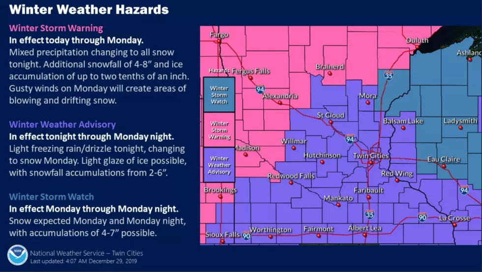
The area we are in currently is classified as a winter weather advisory area and we can expect to see "light freezing rain and drizzle tonight that will change over into snow Monday." The NWS Twin Cities is predicting somewhere between 2-6 inches of snow falling by the time Monday warps up.
As you can see by the NWS Twin Cities graphic below we are looking at 4-6 inches in the Faribault/Owatonna area, while those communities along the I-90 corridor are looking at 3-5 inches of snow.

Monday is expected to be blustery as well with blowing a drifting snow a factor as the day goes along. Be sure to be winter-ready on your commute to work on Monday morning.

More From KRFO-FM