Severe Storms and Heavy Rain Possible Tonight/Tomorrow
There is a possibility of a severe storms and heavy rain in SE Minnesota Monday Night and continuing into Tuesday morning.

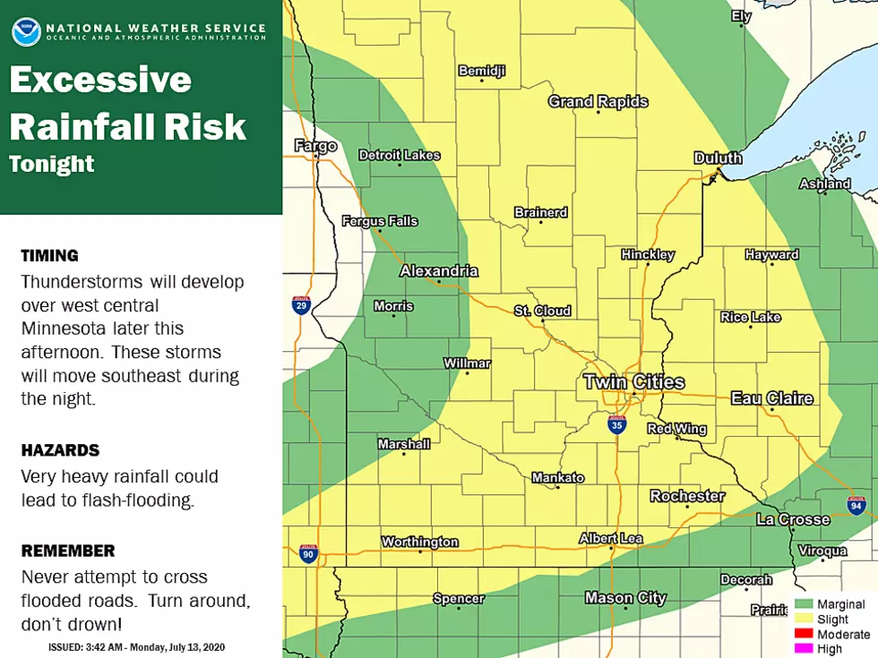
Severe Thunderstorm are expected to develop over West-Central Minnesota late Monday afternoon and move towards the south east over night. The biggest hazard from this cell is heavy rains which could lead to potential flash flooding in the area. straight line winds and hail are also possible hazards.

As a reminder, be aware of road conditions later this evening as flood waters are hard to see in the dark. You can always stay up to date with the latest weather forecast by downloading our free app.

SAY WHAT? 20 of the Hardest Lake Names to Pronounce in Minnesota
Wake up with Jarred Becker every weekday morning from 6a-10a on AM 1390 KRFO
Connect with me on Social Media!
Twitter - @Jarred_Becker
Facebook - Jarred Becker
More From KRFO-FM
![Kane Brown’s Adorable Daughter Kingsley Laughing Wins the Internet Today [Watch]](http://townsquare.media/site/204/files/2020/07/kane-brown-laugh.jpg?w=980&q=75)